6 Sights in Westport-Belmullet Municipal District, Ireland (with Map and Images)
Legend
Welcome to your journey through the most beautiful sights in Westport-Belmullet Municipal District, Ireland! Whether you want to discover the city's historical treasures or experience its modern highlights, you'll find everything your heart desires here. Be inspired by our selection and plan your unforgettable adventure in Westport-Belmullet Municipal District. Dive into the diversity of this fascinating city and discover everything it has to offer.
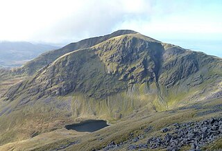
1. Mweelrea
Mweelrea is a mountain on the Atlantic coast of County Mayo, Ireland. Rising to 814 metres (2,671 ft), it is the highest mountain in the western province of Connacht, and is noted for its southeastern cliff-lined corries, and its views. Mweelrea overlooks Killary Harbour and is at the heart of a "horseshoe-shaped" massif that includes the peaks of Ben Lugmore and Ben Bury. The massif is called the Mweelrea Mountains or the Mweelrea Range.
2. Ben Lugmore
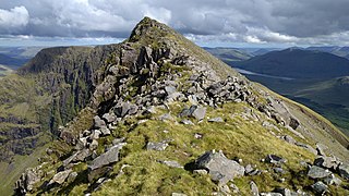
Ben Lugmore at 803 metres (2,635 ft) is the 29th-highest peak in Ireland on the Arderin scale, and the 37th-highest peak on the Vandeleur-Lynam scale. It is in a horseshoe-shaped massif that includes the slightly higher peak of Mweelrea at 814 metres (2,671 ft), the highest mountain in the Irish province of Connacht. The massif is between Killary Harbour and Doo Lough, in County Mayo.
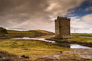
3. Rockfleet Castle
Rockfleet Castle, or Carrickahowley Castle, is a tower house near Newport in County Mayo, Ireland. It was built in the mid-fifteenth century, and is most famously associated with Grace O'Malley, the 'pirate queen' and chieftain of the Clan O’Malley. The castle has been speculated as her place of death. It is also known as Carraigahowley, which means “rock of the fleet”.
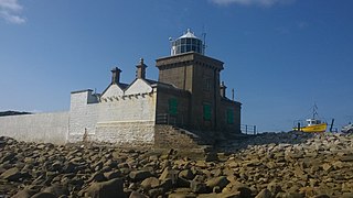
4. Blacksod Lighthouse
Blacksod Lighthouse is a lighthouse at the southern end of the Mullet Peninsula, Erris, County Mayo, at the entrance to Blacksod Bay. It is made of local granite blocks, which are believed to have come from Termon Hill, a nearby isolated outcrop of high-quality granite.
5. Ben Gorm
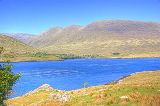
Ben Gorm is a mountain with a height of 700 metres (2,300 ft) on the north side of Killary Harbour in County Mayo, Ireland. The Ben Gorm mountains also includes two other peaks: Ben Creggan/Binn an Charragáin, and Maul Laur/Meall Láir or Ben Creggan South Top.
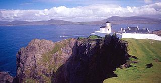
6. Achillbeg Lighthouse
The Achillbeg lighthouse is a lighthouse located on the Achillbeg Island island in the south of Achill Island in the county of Mayo (Ireland). It is managed by the Commissioners of Irish Lights (CIL).
Share
How likely are you to recommend us?
Disclaimer Please be aware of your surroundings and do not enter private property. We are not liable for any damages that occur during the tours.
