9 Sights in The Municipal District of Wicklow, Ireland (with Map and Images)
Legend
Premium Sights
Book tickets, guided tours and activities in The Municipal District of Wicklow.
Guided Free Walking Tours
Book free guided walking tours in The Municipal District of Wicklow.
Welcome to your journey through the most beautiful sights in The Municipal District of Wicklow, Ireland! Whether you want to discover the city's historical treasures or experience its modern highlights, you'll find everything your heart desires here. Be inspired by our selection and plan your unforgettable adventure in The Municipal District of Wicklow. Dive into the diversity of this fascinating city and discover everything it has to offer.
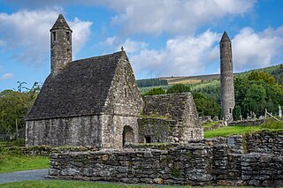
1. Glendalough
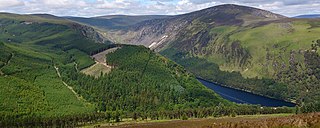
Glendalough is a glacial valley in County Wicklow, Ireland, renowned for an Early Medieval monastic settlement founded in the 6th century by St Kevin. From 1825 to 1957, the head of the Glendalough Valley was the site of a galena lead mine. Glendalough is also a recreational area for picnics, for walking along networks of maintained trails of varying difficulty, and also for rock climbing.
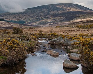
2. Luggala
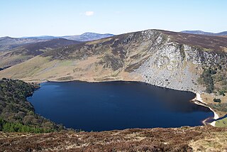
Luggala, also called Fancy Mountain at 595 metres (1,952 ft), is the 230th-highest peak in Ireland on the Arderin scale. Being below 600 metres (2,000 ft), it does not rank on the Vandeleur-Lynam or Hewitt scales. Luggala is in the northeastern section of the Wicklow Mountains in Ireland, and overlooks the Lough Tay, which lies at the base of the steep granite cliffs on Luggala's eastern face. As well as a noted scenic point in County Wicklow, Luggala's eastern cliffs have many graded rock-climbing routes.
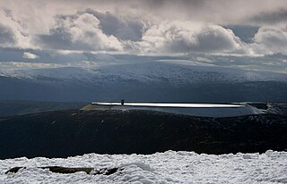
3. Tomaneena
Turlough Hill, also known as Tomaneena, is a 681-metre-high (2,234 ft) mountain in County Wicklow in Ireland and site of Ireland's only pumped-storage hydroelectricity plant. The power station is owned and operated by the ESB and can generate up to 292 megawatts (392,000 hp) of electricity at times of peak demand.
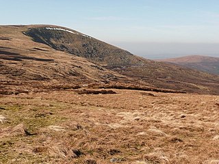
4. Mullaghcleevaun
Mullaghcleevaun at 849 metres (2,785 ft), is the 15th–highest peak in Ireland on the Arderin scale, and the 20th–highest peak on the Vandeleur-Lynam scale. Mullaghcleevaun is in the central sector of the Wicklow Mountains range, in Wicklow, Ireland; it is the 2nd highest peak in Wicklow after Lugnaquilla. Mullaghcleevaun lies on the main "central spine" of the whole range that runs from Kippure in the north, to Lugnaquillia in the south; and in particular, it lies on the continuous "central boggy ridge" that runs from the Sally Gap to Tonelagee.
5. Tonelagee
Tonelagee, is at 817 metres (2,680 ft), is the 25th–highest peak in Ireland on the Arderin scale, and the 33rd–highest peak on the Vandeleur-Lynam scale. Tonelagee is situated in the central sector of the Wicklow Mountains range, and sits on the main "central spine" of the range that runs from Kippure in the north, to Lugnaquillia in the south; and in particular, the continuous "central boggy ridge" that runs from the Sally Gap in the north, via Mullaghcleevaun, to Tonelagee. Tonelagee is the third highest peak in Wicklow after Lugnaquilla and Mullaghcleevaun.
6. Camaderry
Camaderry at 699 metres (2,293 ft), is the 90th-highest peak in Ireland on the Arderin scale, and the 112th-highest peak on the Vandeleur-Lynam scale. Camaderry is situated in the southern sector of the Wicklow Mountains range, and forms a broad horseshoe around the valley of Glendalough with the hydroelectric station at Turlough Hill 681 metres (2,234 ft), and the mountains of Conavalla 734 metres (2,408 ft), and Lugduff 652 metres (2,139 ft). Camaderry has a subsidiary summit, Camaderry South East Top 677 metres (2,221 ft), and both lie across the deep Wicklow Gap from Tonelagee 817 metres (2,680 ft), which sits on the "central spine" of the Wicklow range.
7. Duff Hill
Duff Hill at 720 metres (2,360 ft), is the 78th-highest peak in Ireland on the Arderin scale, and the 97th-highest peak on the Vandeleur-Lynam scale. Duff Hill is in the middle section of the Wicklow Mountains, in County Wicklow, and is part of the large massif of Mullaghcleevaun 849 metres (2,785 ft), which lies to its south. Gravale, which is 718 metres (2,356 ft) tall, lies to its immediate north.
8. Scarr
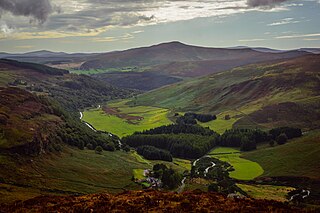
Scarr Mountain at 641 metres (2,103 ft), is the 174th–highest peak in Ireland on the Arderin scale, and the 207th–highest peak on the Vandeleur-Lynam scale. Scarr is situated in the central sector of the Wicklow Mountains range, but off main "central spine" of the range that runs from Kippure in the north, to Lugnaquillia in the south. Scarr lies on its own small massif that includes Scarr North-West Top 561 metres (1,841 ft) and Kanturk 523 metres (1,716 ft); it is bounded by Lough Dan to the east and the Glenmacnass Valley on the west. Scarr's sharp peak gives it a distinctive profile amongst the rounded summits of the Wicklow mountains, and it forms the backdrop to scenic views across the Guinness Estate and Lough Dan.
9. Lugduff
Lugduff at 652 metres (2,139 ft), is the 154th–highest peak in Ireland on the Arderin scale, and the 186th–highest peak on the Vandeleur-Lynam scale. Lugduff is situated in the southern sector of the Wicklow Mountains range, and forms a broad horseshoe around the Upper Lake of the Glendalough valley with the mountains of Mullacor 661 metres (2,169 ft), Conavalla 734 metres (2,408 ft), the hydroelectric station at Turlough Hill 681 metres (2,234 ft), and Camaderry 699 metres (2,293 ft).
Share
How likely are you to recommend us?
Disclaimer Please be aware of your surroundings and do not enter private property. We are not liable for any damages that occur during the tours.
