7 Sights in Bláskógabyggð, Iceland (with Map and Images)
Legend
Welcome to your journey through the most beautiful sights in Bláskógabyggð, Iceland! Whether you want to discover the city's historical treasures or experience its modern highlights, you'll find everything your heart desires here. Be inspired by our selection and plan your unforgettable adventure in Bláskógabyggð. Dive into the diversity of this fascinating city and discover everything it has to offer.
Activities in Bláskógabyggð1. Geysir
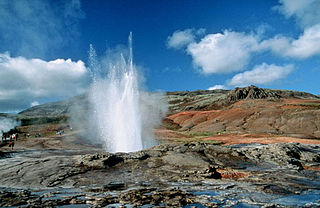
Geysir, sometimes known as The Great Geysir, is a geyser in south-western Iceland, that geological studies suggest started forming about 1150 CE. The English word geyser derives from Geysir. The name Geysir itself is derived from the Icelandic verb geysa. Geysir lies in the Haukadalur valley on the slopes of Laugarfjall lava dome, which is also the home to Strokkur geyser about 50 metres (160 ft) to the south. The Strokkur geyser may be confused with it, and the geothermal field it is in is known usually as either, Geysir or Haukadalur.
2. Þingvellir
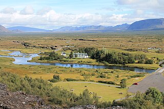
Þingvellir was the site of the Alþing, the annual parliament of Iceland from the year 930 until the last session held at Þingvellir in 1798. Since 1881, the parliament has been located within Alþingishúsið in Reykjavík.
3. Strokkur
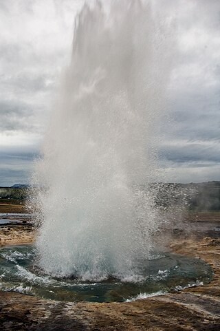
Strokkur is a fountain-type geyser located in a geothermal area beside the Hvítá River in Iceland in the southwest part of the country, east of Reykjavík. It typically erupts every 6–10 minutes. Its usual height is 15–20 metres (49–66 ft), although it can sometimes erupt up to 40 metres (130 ft) high.
4. Silfra Diving
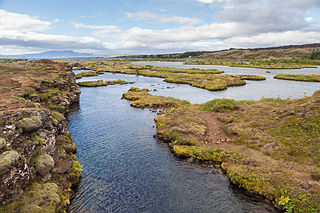
Silfra is a rift formed in the Mid-Atlantic Ridge – the divergent tectonic boundary between the North American and Eurasian plates – and is located in the Þingvallavatn Lake in the Þingvellir National Park in Iceland.
5. Skjaldbreiður
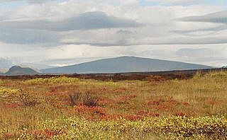
Skjaldbreiður is an Icelandic lava shield formed in a huge and quite protracted eruption series from about roughly 9,500 years ago. The extensive lava fields which were produced by this eruption, flowed southwards, and formed the basin of Þingvallavatn, Iceland's largest lake, and Þingvellir, the "Parliament Plains" where the Icelandic national assembly, the Alþing was founded in 930.
6. Öxarárfoss
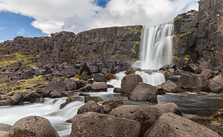
Öxarárfoss is a waterfall in Þingvellir National Park, Iceland. It flows from the river Öxará over the Almannagjá. The pool at the base of the waterfall is filled with rocks and is often extremely icy during winter.
7. Laugarvatnshellir
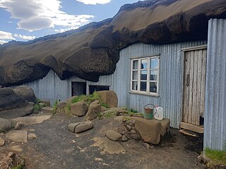
Laugarvatnshellar are man-made tuff caves in Reyðarbarmur at Laugarvatnsvellir, halfway between Þingvellir and Laugarvatn. There were two caves, one four meters wide and 12 meters long, and the other about the same length but narrower. The partition between them has now collapsed. The caves are known for the fact that they were inhabited at the beginning of the 20th century. In earlier centuries, they were used as shelters. There is a lot of graffiti in the tuff on cave walls and outside the mouth of the caves, names, prison boundaries, years, license plates, etc. In 2017, the caves were rebuilt in their original form.
Share
How likely are you to recommend us?
Disclaimer Please be aware of your surroundings and do not enter private property. We are not liable for any damages that occur during the tours.
