11 Sights in Sylt, Germany (with Map and Images)
Legend
Welcome to your journey through the most beautiful sights in Sylt, Germany! Whether you want to discover the city's historical treasures or experience its modern highlights, you'll find everything your heart desires here. Be inspired by our selection and plan your unforgettable adventure in Sylt. Dive into the diversity of this fascinating city and discover everything it has to offer.
Sightseeing Tours in Sylt1. Sankt Martin
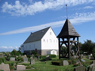
The Church of St. Martin is an Evangelical Lutheran church in Morsum on the island of Sylt. It was named after St. Martin of Tours. The church stands a little away from the village on a flat hilltop in the marsh meadows. In its basic structure, it resembles the Keitum church with a recessed choir and semicircular apse. St. Martin, however, has remained much smaller and towerless. Like the Keitum church, it was first mentioned in a document in 1240.
2. Sankt Severin
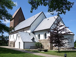
St. Severin is a Lutheran parish church in Keitum on the island of Sylt, northern Germany. It was named after the 4th-century bishop Severin of Cologne. Built in the Romanesque style and first documented in 1240, the church stands back from the town at a higher elevation. Tests have shown that the roof of the church can be dated to 1216, making it the oldest religious building in Schleswig-Holstein. The tower was built around 1450 and served as a navigation mark for seafarers as well as a prison.
3. Harhoog
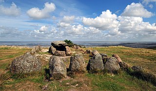
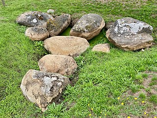
The Harhoog is a dolmen, a rectangular megalithic tomb from the Funnelbeaker culture, located near Keitum on the island of Sylt in Schleswig-Holstein, Germany. Discovered in 1925, it was moved to the present site in 1954 when a new airport was developed.
4. Altfriesisches Haus
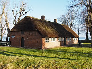
The Old Frisian House since 1640 is a former residential building in the district of Keitum on the island of Sylt, which is used as a museum. It is located directly on the Wadden Sea north of the Hindenburgdamm.
5. Merelmerskhoog
The Merelmerskhoog is a well-preserved Nordic passage tomb. It is located southwest of Archsum on the island of Sylt and belongs to the district of Nordfriesland in Schleswig-Holstein. There it lies in the remains of a round mound of about 15 m in diameter, directly at the foot of the Nössedeich. The people of Sylt call this place Mootjis Küül, "grandmother's hollow", in Sylt Frisian. The grave was excavated and examined in 1877 by Gottfried Heinrich Handelmann (1827–1891).
6. Friedhof der Heimatlosen
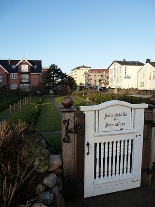
The cemetery of the homeless in Westerland on Sylt, also known as the "homeland for the homeless", was laid out in 1854 by the beach bailiff Wulf Hansen Decker. Up to this point, unknown corpses washed up on the beach were simply left to their own devices. Most of them were sailors who had fallen overboard and drowned. A chronicler counted 418 deaths on Sylt's beaches for the period from 1600 to 1870.
7. Großsteingrab Archsum 1
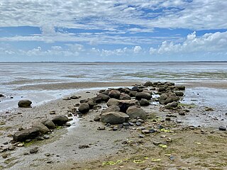
The remains of the two megalithic beds of Archsum are located southwest of Archsum on the island of Sylt, in the district of Nordfriesland in Schleswig-Holstein. They are located on the seaward side of the Nössedeich, close to the Merelmerskhoog. The people of Sylt call this place Mootjis Küül, "grandmother's coolness". They were built between 3500 and 2800 BC and are megalithic sites of the Funnel Beaker Culture (TBK). "Neolithic monuments are an expression of the culture and ideology of Neolithic societies. Their emergence and function are considered to be hallmarks of social development."
8. Sylt Aquarium
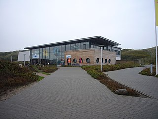
The Sylt Aquarium in the south of the city of Westerland on Sylt is a zoological garden that specializes in fish from the North Sea as well as tropical fish from coral reefs. The aquarium, which was inaugurated in 2004, is located directly on the dune belt and draws its fresh water from a direct pipeline from the North Sea. It offers 25 saltwater pools with about 2000 fish. It has a glass tunnel through which visitors can pass under a basin.
9. Dorfkirche Sankt Niels
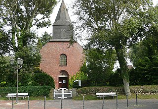
St. Niels is a Lutheran church in Westerland, a seaside resort on the German island of Sylt. Built in 1634 and consecrated in 1637 it is the city’s oldest building and home to a congregation within the Evangelical Lutheran Church in Northern Germany. The church is dedicated to Saint Nicholas, on Sylt called Niels.
10. Stallkirche
Staldkirken is the Danish church in Vesterland on Sylt. It is housed in a thatched Frisian house from 1780, which was bought in 1952. While the main building serves as a vicarage, the barn and stable building are designed as church rooms.
11. Westerländer Roland
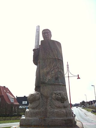
The Westerländer Roland is a sculpture on the island of Sylt. It was built from boulders from 1917 to 1918 and was originally designed as a fountain figure. He is therefore not to be counted among the historical Roland figures. The statue was a gift from the soldiers stationed on Sylt during the First World War to the city of Westerland.
Share
How likely are you to recommend us?
Disclaimer Please be aware of your surroundings and do not enter private property. We are not liable for any damages that occur during the tours.
