26 Sights in Chamonix-Mont-Blanc, France (with Map and Images)
Legend
Welcome to your journey through the most beautiful sights in Chamonix-Mont-Blanc, France! Whether you want to discover the city's historical treasures or experience its modern highlights, you'll find everything your heart desires here. Be inspired by our selection and plan your unforgettable adventure in Chamonix-Mont-Blanc. Dive into the diversity of this fascinating city and discover everything it has to offer.
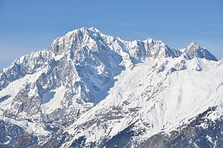
Sightseeing Tours in Chamonix-Mont-Blanc1. Mont Blanc / Monte Bianco
Mont Blanc is the highest mountain in the Alps and Western Europe, and the highest mountain in Europe outside the Caucasus Mountains, rising 4,805.59 m (15,766 ft) above sea level, located on the Franco-Italian border. It is the second-most prominent mountain in Europe, after Mount Elbrus, and the 11th most prominent mountain in the world.
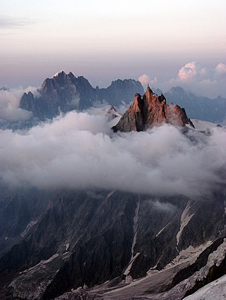
2. Aiguille du Midi
The Aiguille du Midi is a 3,842-metre-tall (12,605 ft) mountain in the Mont Blanc massif within the French Alps. It is a popular tourist destination and can be directly accessed by cable car from Chamonix that takes visitors close to Mont Blanc.
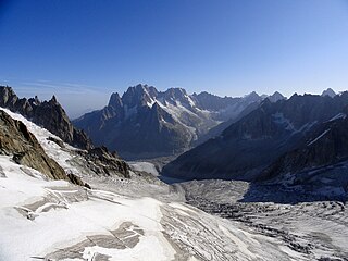
3. Mer de Glace
The Mer de Glace is a valley glacier located on the northern slopes of the Mont Blanc massif, in the French Alps. It is 7.5 km long and 200 metres (660 ft) deep but, when all its tributary glaciers are taken into account, it can be regarded as the longest and largest glacier in France, and the second longest in the Alps after the Aletsch Glacier.I can no otherwise convey to you an image of this body of ice, broken into irregular ridges and deep chasms than by comparing it to waves instantaneously frozen in the midst of a violent storm.
4. Église Saint-Michel
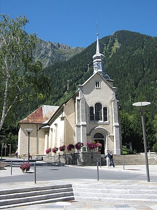
The Church of Saint-Michel in Chamonix-Mont-Blanc is a Catholic church in the Savoyard Baroque or Alpine style with a bulbous bell tower, from the twelfth and nineteenth centuries, placed under the patronage of the Archangel Michael, in Chamonix-Mont-Blanc, in Haute-Savoie. The building was classified as a historical monument in 1979.
5. Mont Maudit / Monte Maudit
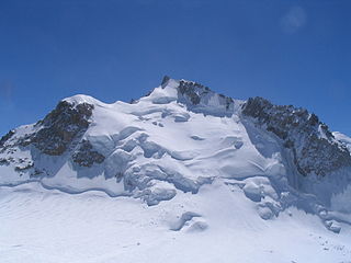
Mont Maudit is a mountain in the Mont Blanc massif in France and Italy. The French name literally means "Cursed Mountain". Until the end of the 18th century, Mont Blanc and its satellite peaks were collectively known in French as the Montagne Maudite.
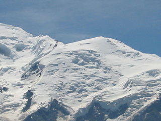
6. Grande Bosse
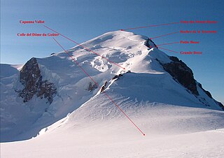
The Grande Bosse is a snowy bulge, culminating at 4,435 or 4,510 m, on the normal route of Mont Blanc, between the dome of the Goûter and the Petite Bosse. It is not part of the official list of 82 peaks in the Alps over 4,000 metres, but appears in the complementary list of secondary peaks.
7. Aiguille du Grépon
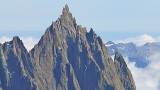
The Aiguille du Grépon, informally known as The Grepon, is a mountain in the Mont Blanc Massif in Haute-Savoie, France. The Grepon has a Southern and Northern peak, which are the highest points of a sharp granite ridge to the east of the Glacier des Nantillons above Chamonix and northeast of the Aiguille du Midi. A madonna statue is situated on the Southern peak.
8. Rocher de la Tournette
The Rocher de la Tournette is a prominent rocky point on the icy summit ridge of Mont Blanc between the Petite Bosse and the summit. The highest point lies at 4,677 metres (15,344 ft) above sea level, and can be most easily reached on an ascent of Mont Blanc via the Goûter Route.
9. Aiguille de Roc
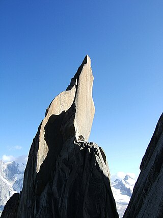
The Aiguille de Roc, which rises to an altitude of 3,407 m, is one of the Aiguilles de Chamonix in the Mont-Blanc massif. It consists of a rocky pinnacle detached in the south-eastern slope of the Aiguille du Grépon.
10. Aiguille du Fou
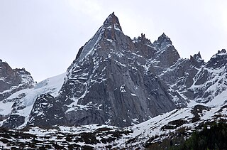
The Aiguille du Fou, which rises to an altitude of 3,501 m, is one of the Aiguilles de Chamonix in the Mont Blanc massif. It is located on the main ridge of the Aiguilles de Chamonix, south of the Aiguille de Blaitière, between the Aiguille des Ciseaux to the north, and the Pointe de Lépiney to the south, from which it is disparaged by the Col du Fou.
11. Glacier de Leschaux
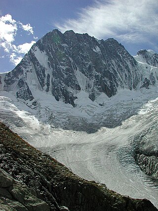
The Leschaux glacier is one of the main glaciers that unite to form the Mer de Glace. It rises at the foot of the Grandes Jorasses, and confluence with the Tacul glacier under the Aiguille du Tacul, at an altitude of around 2,100 metres.
12. Aiguille de Chardonnet
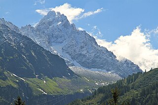
The Aiguille du Chardonnet is a mountain in the Mont Blanc massif in Haute-Savoie, France. It lies between the Glacier du Tour and the Argentière Glacier. The border with Switzerland runs just east of the summit. The East or Forbes Arete provides a popular and classic mountaineering route to the summit.
13. Aiguille du Diable
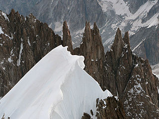
The Aiguilles du Diable are a group of five rock needles, all over 4,000 metres high, on the southeast arête of the Mont Blanc du Tacul. The pinnacles lie within the French part of the Mont Blanc Massif in the departement of Haute-Savoie. The highest needle is L’Isolée (4,114 m), followed by Pointe Carmen (4,109 m), Pointe Médiane (4,097 m), Pointe Chaubert (4,074 m) and Corne du Diable (4,064 m).
14. Aiguille d'Entrèves
The Aiguilles d'Entrèves is a mountain peak in the Mont Blanc massif of the Alps. It is situated at the head of the Glacier du Géant, and its rocky summit ridge forms part of the frontier between France and Italy. It lies east of the Tour Ronde, between the Col d'Entrèves and the Col Occidental de Toule. It has a steep, sound face of red granite and can be readily accessed from the Torino Hut/Pointe Helbronner.
15. Aiguilles Marbrées
The Aiguilles Marbrées, is a mountain peak in the Mont Blanc massif, above the Glacier du Géant, with its summits forming part of the frontier between France and Italy. It is situated between the Col de Rochefort and the Col du Géant, and is easily accessed from the Torino Hut at Pointe Helbronner.
16. Aiguille des Pèlerins - Secteur du Plan
The Aiguille des Pélerins, which rises to an altitude of 3,318 m, is one of the Aiguilles de Chamonix in the Mont Blanc massif. It is located on the range that stands out to the north of the Aiguille du Plan, between the Aiguille des Deux-Aigles and the Aiguille du Peigne.
17. Glacier de Talèfre
The Talèfre Glacier is a glacier in the Mont-Blanc massif of France. During the Little Ice Age, it merged with the Leschaux glacier, forming, with the Tacul glacier, the Mer de Glace. But it is now separated from this glacial complex and ends at an altitude of 2,300 metres, below the Couvert refuge. In the centre of the cirque is a rocky promontory, the Jardin de Talèfre.
18. Aiguille de Rochefort
The Aiguille de Rochefort is a mountain in the Mont Blanc massif in France and Italy. The peak lies on the Rochefort arête between the Dent du Géant and the Grandes Jorasses and is usually climbed during a traverse of the ridge.
19. Grand Flambeau
The Grand Flambeau is a mountain peak in the Mont Blanc massif of the Alps. It is situated at the head of the Géant Glacier, approximately 0.5 km (0.31 mi) east of the Aiguille de Toule, between the Col Orientale de Toule and the Col de Saussure.
20. Mont Mallet
Mont Mallet is a mountain in the Mont Blanc massif in Haute-Savoie, France. It lies on a spur running northwards from the French-Italian frontier ridge, and can be most easily reached from the Aiguille de Rochefort.
21. Aiguille de l'M
The Aiguille de l'M, which rises to an altitude of 2,844 metres, is a massive summit of Mont Blanc. It is the lowest of the Aiguilles de Chamonix, of which it is the northern extremity. It has twin peaks with the northeastern tip and the Albert point.
22. Aiguille de Toula
The Aiguille de Toule is a mountain peak in the Mont Blanc massif of the Alps. Its summit is one of a number which form part of the mountainous frontier ridge between France and Italy which descends eastwards from Mont Blanc and continues towards the Grandes Jorasses and Mont Dolent.
23. Aiguille du Belvédère
Aiguille du Belvédère is a mountain of Haute-Savoie, France. It is the highest peak in the Aiguilles Rouges range of the French Prealps and has an altitude of 2,965 metres (9,728 ft) above sea level.
24. Gros Rognon
The Gros Rognon is a summit culminating at 3,541 meters above sea level, in the French department of Haute-Savoie, between the Géant glacier to the southeast and the Vallée Blanche to the northwest in the Mont-Blanc massif.
25. Le Brévent
Le Brévent is a mountain of Haute-Savoie, France. It lies in the Aiguilles Rouges range of the French Prealps and has an altitude of 2525 metres above sea level. This cliff is a popular spot for wingsuit flying down into the valley.
26. Les Périades
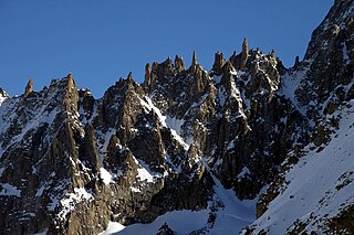
Les Périades is a sharp and heavily-pinnacled mountain ridge, stretching for over 1,500 metres (0.93 mi) in the Mont Blanc massif in Haute-Savoie, France. It runs in a southerly direction from the Col du Tacul to the Col du Mont Mallet. Its highest point is Pointe Cupelin
Share
How likely are you to recommend us?
Disclaimer Please be aware of your surroundings and do not enter private property. We are not liable for any damages that occur during the tours.
