35 Sights in San Pedro de Atacama, Chile (with Map and Images)
Legend
Premium Sights
Book tickets, guided tours and activities in San Pedro de Atacama.
Guided Free Walking Tours
Book free guided walking tours in San Pedro de Atacama.
Welcome to your journey through the most beautiful sights in San Pedro de Atacama, Chile! Whether you want to discover the city's historical treasures or experience its modern highlights, you'll find everything your heart desires here. Be inspired by our selection and plan your unforgettable adventure in San Pedro de Atacama. Dive into the diversity of this fascinating city and discover everything it has to offer.
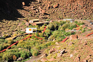
Activities in San Pedro de AtacamaPuritama Hot Springs is a series of eight large pools of geothermal spring water located at the bottom of a canyon in the Atacama Desert, in the Antofagasta Region in the north of Chile. It is located at an altitude of 3,475 meters above sea level, 30 km northeast of the town and commune of San Pedro de Atacama and 348 km northeast of Antofagasta, and is a popular tourist attraction.
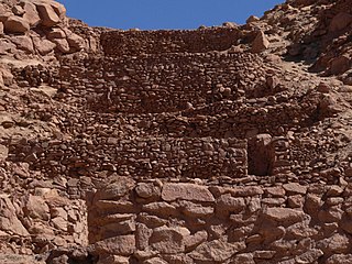
Pukará de Quitor is a pre-Columbian archaeological site in northern Chile. This stone fortress is located 3 km northwest of the town of San Pedro de Atacama, overlooking the valley of the river San Pedro. It was designated a national monument in 1982.
3. Atacama Compact Array (ACA)
.jpg)
The Atacama Large Millimeter/submillimeter Array (ALMA) is an astronomical interferometer of 66 radio telescopes in the Atacama Desert of northern Chile, which observe electromagnetic radiation at millimeter and submillimeter wavelengths. The array has been constructed on the 5,000 m (16,000 ft) elevation Chajnantor plateau – near the Llano de Chajnantor Observatory and the Atacama Pathfinder Experiment. This location was chosen for its high elevation and low humidity, factors which are crucial to reduce noise and decrease signal attenuation due to Earth's atmosphere. ALMA provides insight on star birth during the early Stelliferous era and detailed imaging of local star and planet formation.
4. Volcán Licancabur
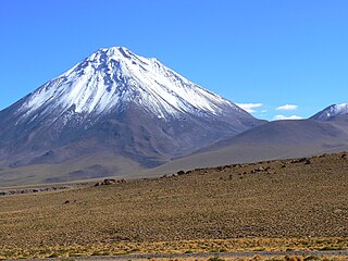
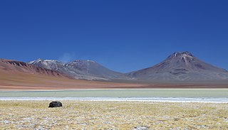
Licancabur is a stratovolcano on the border between Bolivia and Chile, south of the Sairecabur volcano and west of Juriques. Part of the Andean Central Volcanic Zone, it has a prominent, 5,916-metre (19,409 ft)-high cone. A 400–500-metre (1,300–1,600 ft) summit crater containing Licancabur Lake, a crater lake which is among the highest lakes in the world, caps the volcano. There are no glaciers owing to the arid climate. Numerous animal species and plants live on the mountain.
5. Sairecábur
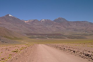
Sairecabur is a volcano located on the frontier between Bolivia and Chile. It is part of the Andean Central Volcanic Zone. Sairecabur proper is 5,971 m (19,590 ft) high; other mountains in the range are 5,722 m (18,773 ft) high Curiquinca, 5,819 m (19,091 ft) high Escalante and 5,748 m (18,858 ft) high Cerro Colorado, all of which have erupted a number of lava flows. Also in close proximity to Sairecabur lie the volcanic centres Licancabur, Putana and Juriques.
6. Atacama Cosmology Telescope (ACT)
.jpg)
The Atacama Cosmology Telescope (ACT) was a cosmological millimeter-wave telescope located on Cerro Toco in the Atacama Desert in the north of Chile. ACT made high-sensitivity, arcminute resolution, microwave-wavelength surveys of the sky in order to study the cosmic microwave background radiation (CMB), the relic radiation left by the Big Bang process. Located 40 km from San Pedro de Atacama, at an altitude of 5,190 metres (17,030 ft), it was one of the highest ground-based telescopes in the world.
7. Volcán Acamarachi
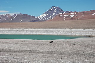
Acamarachi is a 6,046-metre (19,836 ft) high volcano in northern Chile. In this part of Chile, it is the highest volcano. Its name means "black moon". It is a volcano in the Central Volcanic Zone of the Andes, a zone of strong volcanic activity during the last million years. Old volcanoes in the area are well-preserved, due to the dry climate.
8. Cerro Pico El Laco
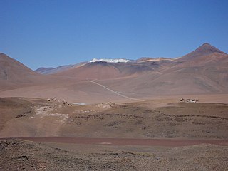
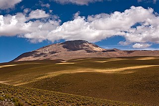
El Laco is a volcanic complex in the Antofagasta Region of Chile. It is directly south of the Cordón de Puntas Negras volcanic chain. Part of the Central Volcanic Zone of the Andes, it is a group of seven stratovolcanoes and a caldera. It is about two million years old. The main summit of the volcano is a lava dome called Pico Laco, which is variously reported to be 5,325 metres (17,470 ft) or 5,472 metres (17,953 ft) high. The edifice has been affected by glaciation, and some reports indicate that it is still fumarolically active.
9. Volcán Putana
Volcán Putana, sometimes referred to as Jorqencal or Machuca, is a stratovolcano located In the Central Volcanic Zone (CVZ) of the Andes on the border between Bolivia and Chile and close to the Sairecabur volcanic complex. Its summit is 5,884 metres (19,304 ft) above sea level and contains a summit crater with two smaller craters nested within it. Beneath the summit, the volcano features a number of lava domes and lava flows, some of which originated in flank vents.
10. Cerro Tocorpuri
Tocorpuri is a volcano in Chile, close to the border with Bolivia. Its peak height is most recently given as 5,808 metres (19,055 ft) and it features a 1.3 kilometres (0.81 mi) wide summit crater. The volcano consists mainly of lava flows and pyroclastic deposits and is subdivided into two separate edifices. Just west of Tocorpuri, the La Torta lava dome is a 200 metres (660 ft) high flat-topped structure. The volcanoes are formed by andesitic, dacitic and rhyolitic rocks.
11. Cosmology Large Angular Scale Surveyor
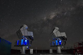
The Cosmology Large Angular Scale Surveyor (CLASS) is an array of microwave telescopes at a high-altitude site in the Atacama Desert of Chile as part of the Parque Astronómico de Atacama. The CLASS experiment aims to improve our understanding of cosmic dawn when the first stars turned on, test the theory of cosmic inflation, and distinguish between inflationary models of the very early universe by making precise measurements of the polarization of the Cosmic Microwave Background (CMB) over 65% of the sky at multiple frequencies in the microwave region of the electromagnetic spectrum.
12. Volcán Aguas Calientes
Aguas Calientes Volcano or Cerro Aguas Calientes, also called Simba, is a cone-shaped stratovolcano located 5 kilometres (3 mi) east of the Lascar volcano and 14 kilometres (8.7 mi) north of Laguna Lejía, Chile. It is located within a 500 square kilometres (190 sq mi) area where the Cordón de Puntas Negras and the Cordón Chalviri volcanic chains intersect. The volcano is constructed from andesite and dacite containing hornblende and anhydrite; its pyroclastics are all older than Lascar. It has a diameter of about 7 kilometres (4.3 mi). Some xenoliths of calc-alkaline material are found in Aguas Calientes lavas, and magma mixing has generated lavas containing andesite inclusions in dacites. One eruption of Aguas Calientes postdates the first centre of Lascar and was originally linked to the Lascar Piedras Grandes eruption, before sampling on the deposits of this eruption indicated a relationship with the Lascar volcano itself. Effusion of lava ceased after the cone was built. One summit lava flow may be of Holocene age, but no evidence of historical activity is found.
13. Cosmic Background Imager (CBI)
The Cosmic Background Imager was a 13-element interferometer perched at an elevation of 5,080 metres at Llano de Chajnantor Observatory in the Chilean Andes. It started operations in 1999 to study the cosmic microwave background radiation and ran until 2008.
14. Simons Array/POLARBEAR
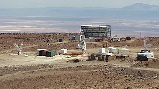
The Simons Observatory is located in the high Atacama Desert in Northern Chile inside the Chajnator Science Preserve, at an altitude of 5,200 meters (17,000 ft). The Atacama Cosmology Telescope (ACT) and the Simons Array are located nearby and these experiments are currently making observations of the Cosmic Microwave Background (CMB). Their goals are to study how the universe began, what it is made of, and how it evolved to its current state. The Simons Observatory shares many of the same goals but aims to take advantage of advances in technology to make far more precise and diverse measurements. In addition, it is envisaged that many aspects of the Simons Observatory will be pathfinders for the future CMB-S4 array.
15. Volcán Miñiques
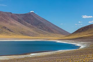
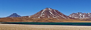
Miñiques is a massive volcanic complex containing a large number of craters, lava domes and flows, located in the Antofagasta Region of Chile. Located 21 km (13 mi) south of Volcán Chiliques and 26 km (16 mi) west of Cordón Puntas Negras, it is part of a frequently visited attraction conformed by the high plain lagoons Laguna Miscanti, Laguna Miñiques and the Cerro Miscanti volcano.
16. Cerro Zapaleri
Zapaleri is a volcano whose summit is the tripoint of the borders of Argentina, Bolivia and Chile. A number of railways are in the area. It is part of Potosí Department (Bolivia), Jujuy Province (Argentina), and Antofagasta Region (Chile). The volcano formed on top of the 2.89 mya Tara Ignimbrite from the Guacha caldera and the basement beneath the volcano is formed from Cretaceous and Tertiary rocks affected by tectonic deformation. Volcanic rocks are andesite, basalt, dacite and rhyolite. Late Cretaceous rocks are also found in the area, as are Pleistocene shoshonite volcanic rocks.
17. Cerro Púlar
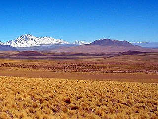
Pular is a massive stratovolcano located in the Antofagasta Region of northern Chile, about 15 km west of the border with Argentina, which in this area is a straight line between the summits of Socompa volcano and Cerro del Rincón. Pular, along with Cerro Pajonales, forms a high volcanic ridge, which runs in a generally north-east to south-west direction for 12 km (7 mi). Southward, following the same direction as the ridge, lies Socompa volcano. The ridge's crest forms a drainage divide between Salar de Atacama basin and Salar de Pular basin. This latter is a bowl-shaped basin enclosed on the east by Aracar volcano.
18. c(TAO)
.jpg)
The University of Tokyo Atacama Observatory (TAO) is an astronomical observatory located on the summit of Cerro Chajnantor, at an altitude of 5,640 m (18,500 ft) within a lava dome in the Atacama Desert of northern Chile. The site is located less than 5 km (3.1 mi) north-northeast of the Llano de Chajnantor Observatory, where the Atacama Large Millimeter Array (ALMA) is located, but is over 580 m (1,900 ft) higher in elevation. It is also 28 m (92 ft) higher than the site proposed for the Fred Young Submillimeter Telescope on the same peak. The observatory is operated by the Graduate School of Science and Faculty of Science, University of Tokyo. Operation began in 2024.
19. Cerro Tumisa
Tumisa is a Pleistocene stratovolcano in the Andes. Located east of the Salar de Atacama, it is part of the Central Volcanic Zone, which since the Miocene has been subject to extensive andesitic/dacitic effusive activity and ignimbrite eruptions. The basement on which Tumisa is built includes Paleozoic rocks and more recent volcanic products of the Lejia volcano and the Atana and Patao ignimbrites.
20. Iglesia San Pedro
The Church of San Pedro de Atacama is a Catholic church in San Pedro de Atacama, Chile. Constructed during the Spanish colonial period, it is reportedly the second oldest church in Chile. Indigenous adobe material was used in the church's construction, whose appearance is characterized as simple and elegant. The church was built in the seventeenth century, underwent modifications in the eighteenth century, and additions were made in the nineteenth century. The church was declared a historical monument in 1951.
21. Cerro Caichinque
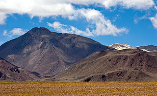
Caichinque is a volcanic complex lying between Salar de Talar and Salar de Capur, in the high Andean plateau of the Antofagasta Region, in Chile. It is located southwest of the Salar de Atacama, directly S of Cerro Miñiques and SE of Cordón Puntas Negras forming part of the main branch of the Andean volcanic chain in this area. Route CH-23 is an approach road to the volcano area and could be impacted by eruptions.
22. Cerro Miscanti
Cerro Miscanti is a mountain of volcanic origin located in the Antofagasta Region of Chile, immediately south of Chiliques and north of Miñiques. It towers over Laguna Miscanti. Rock samples from Cerro Miscanti are of andesitic composition, but andesite-containing dacites have also been found.
23. Juriques
Juriques is a stratovolcano on the border between Bolivia and Chile. It is located immediately southeast of Licancabur volcano. Its summit is at 5,704 m (18,714 ft) with a crater 1.5 km (0.93 mi) in its longest diameter. Laguna Verde lies at the foot of this volcano.
24. Cerros de Incahuasi
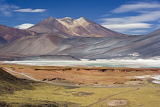
Cerros de Incahuasi is a mountain with several summits located in the Antofagasta Region of Chile, near Sico Pass. The present–day mountain is the result of the partial collapse of an ancient volcanic edifice.
25. Cerro Toco
Cerro Toco is a stratovolcano located in the eastern part of the Atacama Desert in Chile's II Region (Antofagasta), approximately 6 km (4 mi) south of the border between Bolivia and Chile and 12 km (7 mi) SE of the Juriques and Licancabur volcanoes. It conforms the north eastern extreme of the Purico Complex, a pyroclastic shield made up by several stratovolcanoes, lava domes and a maar.
26. Cerro Curiquinca
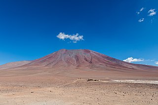
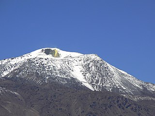
Curiquinca is a stratovolcano that straddles the border between Bolivia and Chile. It lies immediately E of Cerro Colorado and NE to volcán Escalante, all of which are considered to be part of the Sairecabur volcanic group. The light area behind the mountain is part of a large sulfur deposit, location of the - now abandoned - sulfur mines "Azufrera El Apagado" on the Chilean side and its counterpart "Azufrera Rosita" on the Bolivian side of the border.
27. Cerro El Chascón
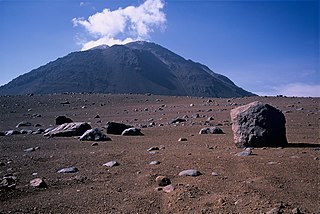
Cerro El Chascón is a dormant volcano in the Antofagasta region a few kilometers from the border with Bolivia and 53 km east of San Pedro de Atacama. In its vicinity we can find Chajnantor Hill and Toco Hill, located next to the Chascón on the edges of the Chajnantor Plateau where there are several astronomical observatories such as the ALMA radio telescope array. It belongs to the Puricó Volcanic Complex and is in 79th place in the ranking of active volcanoes of Sernageomin in relation to its activity and dangerousness.
28. Volcán Escalante
Volcán Escalante also known as "El Apagado" is a stratovolcano on the Chilean side of the border between Bolivia and Chile. It lies immediately SE of Cerro Colorado and SW to volcán Curiquinca, all of which are considered to be part of the Sairecabur volcanic group.
29. Nevados de Poquis
Nevados de Poquis is a mountain in the Andes of Chile, close to the border with Argentina. It has a height of 5,756 meters (18,885 ft), and is located north of Paso de Jama and southeast of Zapaleri.
30. Cerro Incahuasi
Cerro Incahuasi, also spelled as Cerro Incaguasi, is a mountain in the Andes of Chile. It is located immediately south of Guayaques volcanic group and north of the Cerros de La Pacana, the resurgent dome of La Pacana caldera. The mountain features an exposed hydrothermal alteration zone.
31. Cerro Quimal
Cerro del Quimal is a mountain in Chile. It is located in the province of Antofagasta and the region of the Región de Antofagasta, in the north of the country, 1,200 km north of the capital Santiago de Chile. The summit of Cerro del Quimal is 4,274 meters above sea level.
32. Cerro Curón
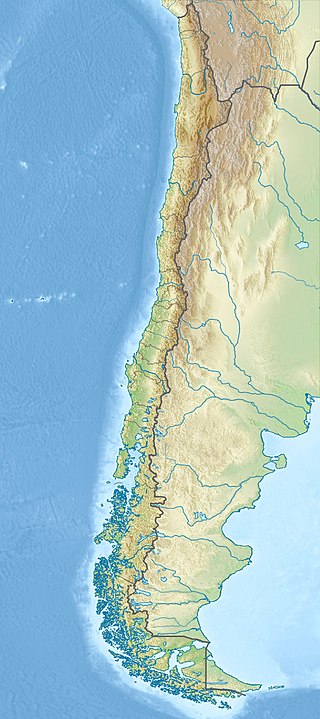
Cerro Curon is a mountain in Chile. It is located in the province of Provincia de El Loa and the region of Región de Antofagasta, in the north of the country, 1,200 km north of the capital Santiago de Chile. The summit of Cerro Curon is 3,861 meters above sea level.
33. Volcán Laguna Verde
Cerro Laguna Verde is one of the many stratovolcanoes that integrate a 180 km (112 mi)-long chain east of the Gran Salar de Atacama in Chile's II Region. The mountain is located 6 km (4 mi) west of Acamarachi and 12.5 km (8 mi) north of the Aguas Calientes (Simbad) and Lascar stratovolcanoes.
34. Iglesia de San Lucas
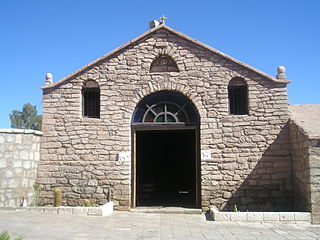
The Church of San Lucas is a Roman Catholic church located in the town of Toconao, San Pedro de Atacama, Antofagasta Region, Chile. Together with its bell tower, which is separated from the church, it was declared a national monument of Chile, in the category of historical monument, by Supreme Decree No. 5058, of July 6, 1951.
35. Cerros de Macón
The Purico complex is a Pleistocene volcanic complex in Chile close to Bolivia, formed by an ignimbrite, several lava domes and stratovolcanoes and one maar. It is in the Chilean segment of the Central Volcanic Zone, one of the four volcanic belts which make up the Andean Volcanic Belt. The Central Volcanic Zone spans Peru, Bolivia, Chile and Argentina and includes 44 active volcanoes as well as the Altiplano–Puna volcanic complex, a system of large calderas and ignimbrites of which Purico is a member. Licancabur to the north, La Pacana southeast and Guayaques to the east are separate volcanic systems.
Share
How likely are you to recommend us?
Disclaimer Please be aware of your surroundings and do not enter private property. We are not liable for any damages that occur during the tours.
.jpeg)
