35 Sights in Puerto Natales, Chile (with Map and Images)
Legend
Welcome to your journey through the most beautiful sights in Puerto Natales, Chile! Whether you want to discover the city's historical treasures or experience its modern highlights, you'll find everything your heart desires here. Be inspired by our selection and plan your unforgettable adventure in Puerto Natales. Dive into the diversity of this fascinating city and discover everything it has to offer.
Activities in Puerto Natales1. Cerro Torre
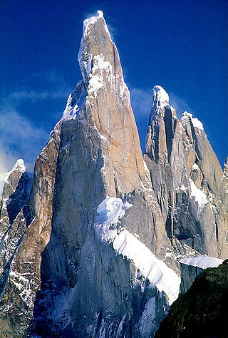
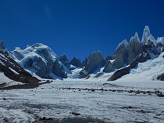
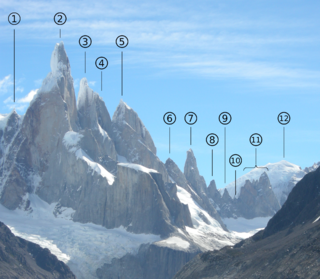
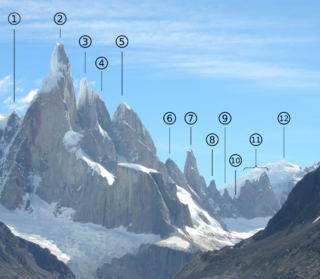
Cerro Torre is one of the mountains of the Southern Patagonian Ice Field in South America. It is located in Argentina and Chile, west of Fitz Roy. At 3,128 m (10,262 ft), the peak is the highest of a four mountain chain: the other peaks are Torre Egger, Punta Herron, and Cerro Standhardt. The top of the mountain often has a mushroom of rime ice, formed by the constant strong winds, increasing the difficulty of reaching the actual summit.
2. Monte Burney
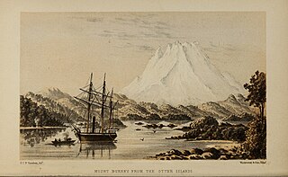
Monte Burney is a volcano in southern Chile, part of its Austral Volcanic Zone which consists of six volcanoes with activity during the Quaternary. This volcanism is linked to the subduction of the Antarctic Plate beneath the South America Plate and the Scotia Plate.
3. Volcán Reclus
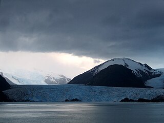
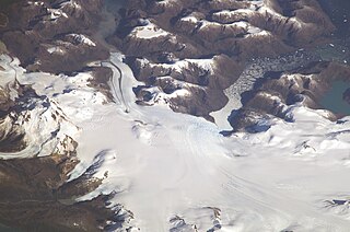
Reclus, also written as Reclús, is a cinder cone and stratovolcano located in the Southern Patagonian Ice Field, Chile. Part of the Austral Volcanic Zone of the Andes, its summit rises 1,000 metres (3,300 ft) above sea level and is capped by a crater about 1 kilometre (0.62 mi) wide. Close to the volcano lies the Amalia Glacier, which is actively eroding Reclus.
4. Volcán Lautaro
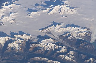
Lautaro is an active subglacial stratovolcano located in Chilean Patagonia, in the northern part of the Southern Patagonian Ice Field. Its summit rises roughly 2,400 m (7,900 ft) above the average surface of the ice cap plateau.
5. Volcán Aguilera
Aguilera is a stratovolcano in southern Chile. The volcano rises above the edge of the Southern Patagonian Ice Field. It is a remote volcano that was identified as such in 1985. The first ascent only occurred in 2014, making it the last unclimbed major Andean volcano.
6. Devils Chair
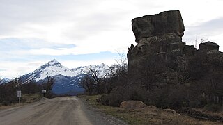
La Silla del Diablo is a rock belonging to the conglomerate of Lake Sofia located at the entrance of the Cueva del Milodón natural monument, 24 kilometers north of Puerto Natales, in the province of Última Esperanza.
7. Faro Evangelistas
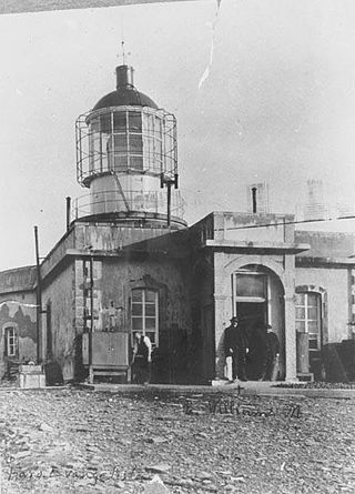
The Evangelistas Lighthouse is one of the most exposed, isolated and least accessible in the world. Sited on the Evangelistas Islets on Chile's continental shelf in the south-eastern Pacific Ocean, it is the landfall light for ships crossing the Pacific eastwards to traverse the Strait of Magellan. A notable engineering accomplishment of its time, it was built by Scottish engineer George Henry Slight who had been recruited by Chilean President Jorge Montt, through the Chilean ambassador in London Agustin Ross, in order to establish a lighthouse service in Chile. Work on the lighthouse commenced on 30 April 1895. Slight's diary records his impressions of the Evangelistas on his arrival there:I never imagined seeing something so wild and desolate as those emerging dark rocks in the middle of the raging waves. To see these stormy craggy rocks was frightening. With a dim light on the horizon we could see large waves crashing heavily in the western part of the islands: a vision that hardly anyone can imagine...
8. Faro Islote Fairway
The Islote Fairway Lighthouse is one of the lighthouses located in the Islotes Fairway sector in the Strait of Magellan. It belongs to the Chilean lighthouse network, entering service in 1920. Inhabited lighthouse.
9. Cerro Huemul
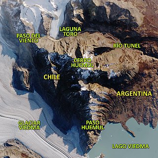
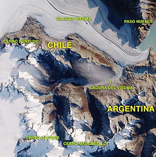
Cerro Huemul is a glaciated mountain in the Andes Mountains in Patagonia, located on the eastern edge of the Patagonian ice field south west of Lake Viedma and north of the homonymous glacier within the disputed area between Chile and Argentina.
10. Monte Balmaceda
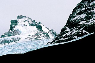
Monte Balmaceda is a heavily glaciated mountain located in the Magallanes Region of Chile. It stands at the head of Última Esperanza Sound, in the south portion of Bernardo O'Higgins National Park and near the mouth of the Serrano River. The glaciers Balmaceda and Serrano mantle the slopes of the mount.
11. Circo de los Altares
The Circo de los Altares is a geological formation of the Patagonian Andes, located in the Southern Patagonian Ice Field, where Mount Torre and Mount Fitz Roy can be seen from its western sides. It is located within the Area in dispute between Chile and Argentina with the border being defined in the northern area of the site.
12. Cerro Domo Blanco
Cerro Domo Blanco is a glaciated mountain of the southern Patagonian ice field in Patagonia, located on the border between Chile and Argentina. It is located west of Mount Fitz Roy, east of Cerro Rincón, and in the northern part of the Cirque de los Altares. It is located at an altitude of 2465 m a.s.l.
Wikipedia: Cerro Domo Blanco (campo de hielo patagónico sur) (ES)
13. Cerro Cuerno
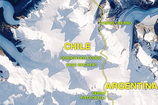
Cerro Cuerno Blanco is a mountain on the border between Argentina and Chile in the southern Patagonian ice field. It is part of the Bernardo O'Higgins National Park on its Chilean side and the Los Glaciares National Park on its Argentine side, administratively it is located in the Magallanes and Chilean Antarctic region on its Chilean side and in the province of Santa Cruz on the Argentine side. It has an altitude of 2060 meters above sea level.
14. Cerro Comandante Dublé Almeyda
Cerro Comandante Dublé Almeyda, Cerro Commander Piedrabuena or Cerro Sonunta is a mountain on the border between Argentina and Chile in the South Patagonian ice field with an altitude of 2468 meters above sea level.
15. Aguja Cuatro Dedos
The needle or Cuatro Dedos hill is a mountain in Chile that is located in the Cordillera del Chaltén natural site of the Bernardo O'Higgins National Park in the commune of Natales, province of Última Esperanza in the region of Magallanes and Chilean Antarctica. It is part of the Torre cordon.
16. Cerro Torino Este
Cerro Torino Este is a mountain on the border between Argentina and Chile in the southern Patagonian ice field with an altitude of 2671 meters above sea level. The hill is located northwest of Cerro Cono, and northwest of Cerro Bertachi.
17. Punto N;Cerro Dos Codos
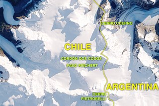
Cerro Dos Codos is a mountain on the border between Argentina and Chile in the southern Patagonian ice field. It is part of the Bernardo O'Higgins National Park on its Chilean side and the Los Glaciares National Park on its Argentine side, administratively it is located in the Magallanes and Chilean Antarctic region on its Chilean side and in the province of Santa Cruz on the Argentine side. It has an altitude of 2350 meters above sea level. Its 2 summits were climbed only once, in October 2016 by Luli Gaviña, Violeta Lauria, and Fernando Armani, who used the East ridge as a route.
18. Cerro Puntudo
Cerro Puntudo is a mountain located in the southern Patagonian ice field within the disputed area between Chile and Argentina. It is located south of the Viedma glacier and east of the Mariano Moreno mountain range.
19. Aguja Desmochada
Desmochada Needle is a mountain on the border of Argentina and Chile that is located in the Cordillera del Chaltén natural site within the Bernardo O'Higgins National Park in Chile and Los Glaciares National Park in Argentina. In Chile it is found in the commune of Natales, province of Última Esperanza in the region of Magallanes and Chilean Antarctica and in Argentina in the department of Lago Argentino of the province of Santa Cruz.
20. Aguja de la Silla
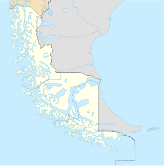
La Aguja de la Silla is a mountain in Chile that is located in the Cordillera del Chaltén natural site of the Bernardo O'Higgins National Park in the commune of Natales, province of Última Esperanza in the region of Magallanes and Chilean Antarctica. It is part of the Fitz Roy Range and is located west of the mountain pass and border with Argentina, Brecha de los Italianos.
21. Cerro Gardener
Cerro Gardener is a mountain on the border between Argentina and Chile in the southern Patagonian ice field. It is part of the Bernardo O'Higgins National Park on its Chilean side and the Los Glaciares National Park on its Argentine side, administratively it is located in the Magallanes and Chilean Antarctic region on its Chilean side and in the province of Santa Cruz on the Argentine side. It has an altitude of 2448 meters above sea level. It has been a border hill since the signing of the 1998 agreement between the two countries. It was climbed for the first time using its southern ridge on September 18, 1993 by Alberto Del Castillo, Paula Marechal and José Luis Fonrouge. The second ascent was made by Fernando Armani and Luli Gaviña, 20 years later, in 2013 on the Northwest face, and to date it has not been climbed again.
22. Cerro Rincón
Cerro Rincón is a glaciated mountain of the southern Patagonian ice field in Patagonia, located on the border between Chile and Argentina. It is located west of the Domo Blanco hill, south of the Marconi glacier and in the northern part of the Cirque dei Altares. It is located at an altitude of 2422 m a.s.l.
Wikipedia: Cerro Rincón (campo de hielo patagónico sur) (ES)
23. Cerro Don Bosco
Mount Don Bosco is a mountain located in the southern Patagonian ice field within the disputed area between Chile and Argentina. It is located south of the Viedma glacier and east of the Mariano Moreno mountain range.
24. Cerro Almirante Óscar Viel
Cerro Almirante Óscar Viel or Cerro Teniente Feilberg is a mountain on the border between Argentina and Chile in the southern Patagonian ice field with an altitude of 2602 meters above sea level. It is part of the Piedrabuena cord.
Wikipedia: Cerro Almirante Óscar Viel/Teniente Feilberg (ES)
25. Aguja Bífida
The Bifida needle is a mountain in Chile that is located in the Cordillera del Chaltén natural site of the Bernardo O'Higgins National Park in the commune of Natales, province of Última Esperanza in the region of Magallanes and Chilean Antarctica. It is part of the Torre cordon.
26. Cerro Spegazzini Norte
Spegazzini Norte Hill is a mountain on the border between Argentina and Chile in the southern Patagonian ice field. It is part of the Bernardo O'Higgins National Park on its Chilean side and the Los Glaciares National Park on its Argentine side, administratively it is located in the Magallanes and Chilean Antarctic region on its Chilean side and in the province of Santa Cruz on the Argentine side. It has an altitude of 2361 meters above sea level. It has been a border hill since the signing of the 1998 agreement between the two countries.
27. Cerro Inmaculado
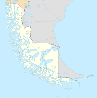
Cerro Inmaculado is a mountain in Chile that is located in the Bernardo O'Higgins National Park in the commune of Natales, province of Última Esperanza in the region of Magallanes and Chilean Antarctica.
28. Cerro Masters
Mount Masters is a mountain on the border between Argentina and Chile in the southern Patagonian ice field. It is part of the Bernardo O'Higgins National Park on its Chilean side and the Los Glaciares National Park on its Argentine side, administratively it is located in the Magallanes and Chilean Antarctic region on its Chilean side and in the province of Santa Cruz on the Argentine side. It has an altitude of 2834 meters above sea level.
29. Aguja CAT
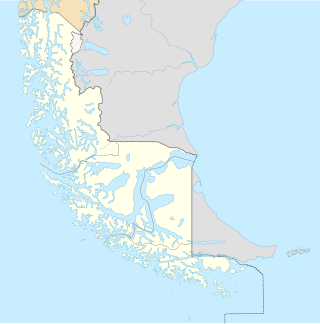
The CAT needle is a mountain in Chile that is located in the Cordillera del Chaltén natural site of the Bernardo O'Higgins National Park in the commune of Natales, province of Última Esperanza in the region of Magallanes and Chilean Antarctica. It is part of the Torre cordon.
30. Cerro Spegazzini Sur
Spegazzini Sur is a mountain on the border between Argentina and Chile in the southern Patagonian ice field. It is part of the Bernardo O'Higgins National Park on its Chilean side and the Los Glaciares National Park on its Argentine side, administratively it is located in the Magallanes and Chilean Antarctic region on its Chilean side and in the province of Santa Cruz on the Argentine side. It has an altitude of 2117 meters above sea level. It has been a border hill since the signing of the 1998 agreement between the two countries.
31. Cerro Dagmar Aaen
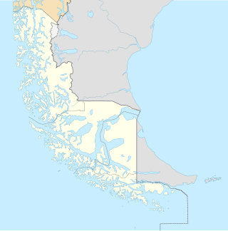
Dagmar Aaen Hill is a mountain in Chile that is located in the Bernardo O'Higgins National Park in the commune of Natales, province of Última Esperanza in the region of Magallanes and Chilean Antarctica.
32. Cerro Padre Hurtado
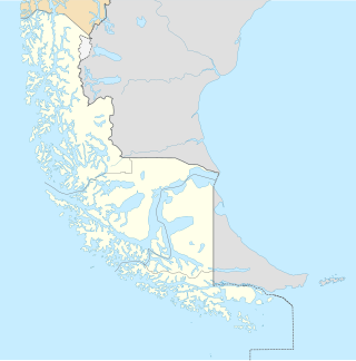
Cerro Padre Hurtado is a mountain in Chile that is located in the Bernardo O'Higgins National Park in the commune of Natales, province of Última Esperanza in the region of Magallanes and Chilean Antarctica.
33. Cerro Campana
Cerro Campana is a glaciated mountain in the Andes Mountains in Patagonia, located on the eastern edge of the Patagonian ice field, south west of Lake Viedma and south of the glacier of the same name within the disputed area between Chile and Argentina.
34. Punta Aparición
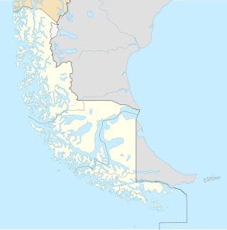
Punta Aparición is a mountain in Chile that is located in the Bernardo O'Higgins National Park in the commune of Natales, province of Última Esperanza in the region of Magallanes and Chilean Antarctica.
35. Cerro Christian Buracchio
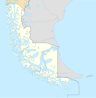
Cerro Christian Buracchio is a mountain in Chile that is located in the Bernardo O'Higgins National Park in the commune of Natales, province of Última Esperanza in the region of Magallanes and Chilean Antarctica.
Share
How likely are you to recommend us?
Disclaimer Please be aware of your surroundings and do not enter private property. We are not liable for any damages that occur during the tours.
