12 Sights in Antofagasta, Chile (with Map and Images)
Legend
Welcome to your journey through the most beautiful sights in Antofagasta, Chile! Whether you want to discover the city's historical treasures or experience its modern highlights, you'll find everything your heart desires here. Be inspired by our selection and plan your unforgettable adventure in Antofagasta. Dive into the diversity of this fascinating city and discover everything it has to offer.
Sightseeing Tours in Antofagasta1. Gabriela Mistral
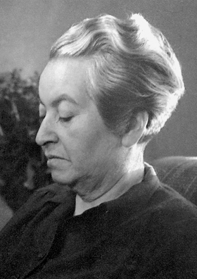
Lucila Godoy Alcayaga, known by her pseudonym Gabriela Mistral, was a Chilean poet-diplomat, educator, and Catholic. She was a member of the Secular Franciscan Order or Third Franciscan order. She was the first Latin American author to receive a Nobel Prize in Literature in 1945, "for her lyric poetry which, inspired by powerful emotions, has made her name a symbol of the idealistic aspirations of the entire Latin American world". Some central themes in her poems are nature, betrayal, love, a mother's love, sorrow and recovery, travel, and Latin American identity as formed from a mixture of Native American and European influences. Her image is featured on the 5,000 Chilean peso banknote.
2. Volcán Llullaillaco
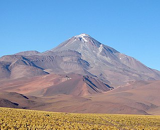
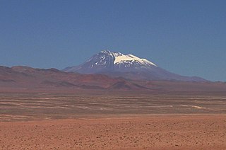
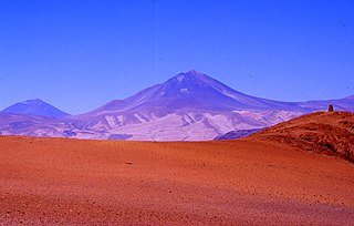
Llullaillaco is a dormant stratovolcano on the border between Argentina and Chile. It lies in the Puna de Atacama, a region of tall volcanic peaks on a high plateau close to the Atacama Desert, one of the driest places in the world. Its maximum elevation is most commonly given as 6723 m, making it the second- or third-highest volcano in the world. Despite its height, it is not clear whether the volcano has any glaciers or merely patches of perennial snow and ice. Between 3700 m and 5000 m elevation there is a sparse plant cover, while at lower altitudes the climate is too dry for plants to grow. A species of mouse on Llullaillaco is the highest-living known vertebrate species.
3. Volcán Socompa
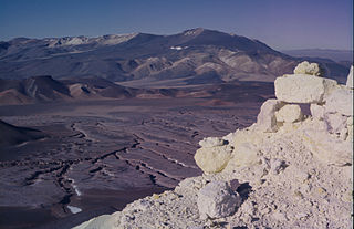
Socompa is a large stratovolcano on the border of Argentina and Chile. It has an elevation of 6,051 metres (19,852 ft) and is part of the Chilean and Argentine Andean Volcanic Belt (AVB). Socompa is within the Central Volcanic Zone, one of the segments of the AVB which contains about 44 active volcanoes. It begins in Peru and runs first through Bolivia and Chile, and then Argentina and Chile. Socompa lies close to the pass of the same name where the Salta-Antofagasta railway crosses the Chilian border.
4. Lastarria
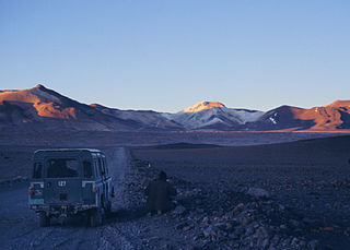
Lastarria is a 5,697 metres (18,691 ft) high stratovolcano that lies on the border between Chile and Argentina. It is remote, and the surroundings are uninhabited but can be reached through an unpaved road. The volcano is part of the Central Volcanic Zone, one of the four segments of the volcanic arc of the Andes. Over a thousand volcanoes—of which about 50 are active—lie in this over 1,500 kilometres (930 mi) long chain of volcanoes, which is generated by subduction of the Nazca Plate beneath the South American Plate.
5. VISTA Telescope
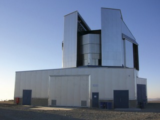
The VISTA is a wide-field reflecting telescope with a 4.1 metre mirror, located at the Paranal Observatory in Chile. It is operated by the European Southern Observatory and started science operations in December 2009. VISTA was conceived and developed by a consortium of universities in the United Kingdom led by Queen Mary University of London and became an in-kind contribution to ESO as part of the UK's accession agreement, with the subscription paid by the UK Science and Technology Facilities Council (STFC).
6. Plaza Colón Antofagasta
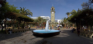
Plaza Colón corresponds to the main square of the city of Antofagasta. It is an urban park in the shape of a block located in the downtown sector of the city, a few blocks from the coast to the Pacific Ocean.
7. Museo Regional de Antofagasta
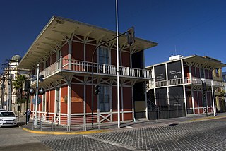
The Museum of Antofagasta is a Chilean historical and archaeological museum, located in the Historic Quarter of Antofagasta. It is one of twenty-six museums managed by the National Cultural Heritage Service.
8. Cerro Escorial
Cerro Escorial is a stratovolcano at the border of Argentina and Chile. It is part of the Corrida de Cori volcanic group and its youngest member. A well-preserved 1-kilometre-wide (0.6 mi) crater forms its summit area. Lava flows are found on the Chilean and smaller ones on the Argentinian side, the former reaching as far as 3–4 kilometres (1.9–2.5 mi) from the volcano. One of these is dated 342,000 years ago by argon-argon dating.
9. Cerro Armazones
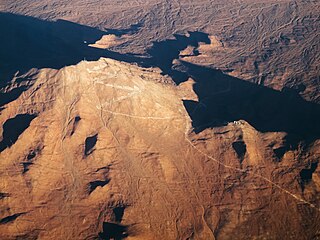
Cerro Armazones is a mountain located in the Sierra Vicuña Mackenna of the Chilean Coast Range of the Andes, approximately 130 km (81 mi) southeast of Antofagasta in the Antofagasta Region, Chile. The mountain is situated in an ideal location for optical astronomy due to its 89% cloudless nights annually. On 26 April 2010, the European Southern Observatory Council selected Cerro Armazones as the site for the planned Extremely Large Telescope (ELT); construction commenced in June 2014. The first light observation is scheduled for 2027.
10. El Negrillar
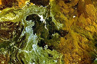
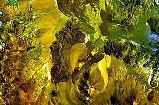
El Negrillar is a volcanic field in the Andes. Located south of the Salar de Atacama and west of the Cordón de Púlar, it generated cinder cones and lava flows. Covering a surface area of 220 square kilometres (85 sq mi), it is the largest volcanic field in northern Chile, with almost a hundred vents that produced mainly lava flows. Owing to the arid climate, landforms are well preserved. Radiometric dating has yielded ages of less than 1.5 million years, with the most recent eruption occurring about 141,000 years ago. Parts of the Holocene Socompa debris avalanche overlie the field. A groundwater system underlies the volcanic field and some cones formed through phreatomagmatic eruptions. El Negrillar is located in a complex tectonic regime, characterized by numerous faults. The town of Tilomonte and various power lines, mines and water wells are in the area.
11. Volcán Salín
Salín is a mountain at the border of Argentina and Chile with an elevation of 6,029 metres (19,780 ft) metres. Salin is within the following mountain ranges: Argentine Andes, Chilean Andes, Puna de Atacama. Its territory is within the Argentinean protection area of Provincial Fauna Reserve Los Andes. It is on the border of 3 provinces: Argentinean province of Salta; Chilean provinces of El Loa and Antofagasta. Its slopes are within 3 cities: Argentinean city of Tolar Grande, Chilean cities of San Pedro de Atacama and Antofagasta (Chile).
12. La Negrillar
La Negrillar is a volcanic cone and associated lava flow in Chile. It covers 16 square kilometres (6.2 sq mi) on the southwestern margin of the Atacama basin. It erupted basalts and andesite and its flows and cones are well preserved. Radiometric dating has yielded ages of 1.4 ± 0.5 and 0.54 ± 0.5 million years. It is one of several mafic centres in the region located along fault systems.
Share
How likely are you to recommend us?
Disclaimer Please be aware of your surroundings and do not enter private property. We are not liable for any damages that occur during the tours.
