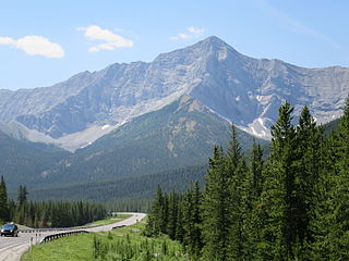
26 Sights in Kananaskis, Canada (with Map and Images)
Legend
Welcome to your journey through the most beautiful sights in Kananaskis, Canada! Whether you want to discover the city's historical treasures or experience its modern highlights, you'll find everything your heart desires here. Be inspired by our selection and plan your unforgettable adventure in Kananaskis. Dive into the diversity of this fascinating city and discover everything it has to offer.
1. Mount Joffre
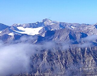
Mount Joffre is a mountain located on the Continental Divide, in Peter Lougheed Provincial Park, Alberta, and Elk Lakes and Height of the Rockies Provincial Parks in British Columbia. The mountain was named in 1918 by the Interprovincial Boundary Survey after Marshal Joseph Joffre, commander-in-chief of the French Army during World War I.
2. Mount Kidd
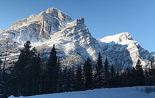
Mount Kidd is a 2,958-metre (9,705-foot) double-summit massif centrally located in Kananaskis Country in the Canadian Rockies of Alberta, Canada. Mount Kidd is situated within Spray Valley Provincial Park, and its nearest higher neighbor is Mount Sparrowhawk, 7.0 km (4.3 mi) to the northwest. Mount Kidd is a landmark that can be seen from Highway 40 in the Kananaskis Village area, and from the Kananaskis Country Golf Course which lies at the eastern base of the mountain.
3. Mount Putnik
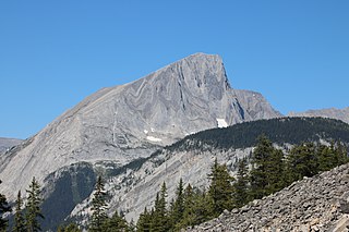
Mount Putnik is a mountain located north of Three Isle Creek and west of the Kananaskis River in Peter Lougheed Provincial Park Alberta, Canada. The mountain is named after the Serbian Field Marshal Radomir Putnik (1847-1917).
4. Mount Rae
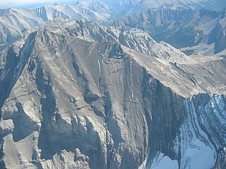
Mount Rae is a mountain located on the eastern side of Highway 40 between Elbow Pass and the Ptarmigan Cirque in the Canadian Rockies of Alberta. Mount Rae was named after John Rae, explorer of Northern Canada, in 1859.
5. Mist Mountain
Mist Mountain is a mountain located alongside Highway 40 in the Canadian Rockies of Alberta, Canada. It reaches an elevation of 3,140 m (10,300 ft) and is visible from Alberta Highway 40 and the Sheep River.
6. Mount Galatea
Mount Galatea is the highest peak of the Kananaskis Range, a subrange of the Canadian Rockies in the province of Alberta. It is located in the upper Spray Lakes Valley of the Kananaskis Country system of provincial parks. The mountain was named after the Royal Navy cruiser HMS Galatea.
7. Mount Tyrwhitt
Mount Tyrwhitt is a mountain in British Columbia and Alberta, Canada, located between Highway 40 and Elk Pass in the Elk Range of the Canadian Rockies, west of the Highwood Pass parking lot in Kananaskis Country and south east of Upper Kananaskis Lake. Located on the Continental Divide, it is also therefore on the border between British Columbia and Alberta, which follows the Divide in this area.
8. Mount Chester
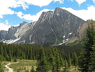
Mount Chester is a mountain located in the Smith-Dorrien Creek Valley of Kananaskis in the Canadian Rockies. The mountain was named in 1917 after HMS Chester, which was severely damaged in the Battle of Jutland.
9. Mount Bishop
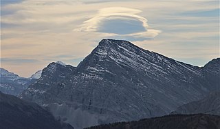
Mount Bishop is a mountain named in 1918 after W.A. "Billy" Bishop VC who was a Colonel and a Canadian fighter pilot awarded the Victoria Cross during World War I. It is located in the Elk Range of the Canadian Rockies and sits on the Continental Divide, which forms the British Columbia-Alberta border in this area.
10. Windtower
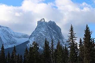
Windtower is a 2,695-metre (8,842-foot) tower-like summit located in the Wind Valley of Kananaskis Country in the Canadian Rockies of Alberta, Canada. Its nearest higher peak is Mount Lougheed, 3.0 km (1.9 mi) to the southeast. Windtower is a conspicuous landmark that can be seen from Highway 1, the Trans-Canada Highway in the Canmore area. Although not of remarkable elevation, the mountain has an imposing, overhanging north face with an appearance similar to peaks in The Bugaboos.
11. Mount Lawrence Grassi
Mount Lawrence Grassi is the tallest peak of the Ehagay Nakoda massif, a multi-peaked mountain located immediately south of the town of Canmore just east of the Spray Lakes road in Alberta's Canadian Rockies. The mountain sports two other subsidiary peaks with commemorative names: Ha Ling Peak on the northwestern end, and Miners Peak located southeast of Ha Ling Peak between Ha Ling Peak and Mount Lawrence Grassi. Another peak on the mountain is named Ship's Prow, which is on the Southeastern end of the mountain. The mountain is separated from Mount Rundle by Whiteman's Gap, and is separated to the South from The Three Sisters by Three Sisters Pass.
12. Mount Pocaterra
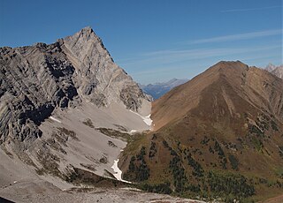
Mount Pocaterra is the unofficial name of a rocky formation named after the Pocaterra Creek in the same region. It is located in the Elk Range in Alberta. This peak is located on the crest of a ridge, about 1.5 km north of the lower Mount Tyrwhitt. The peak is a double summit, with the north summit slightly higher.
13. Mount Robertson
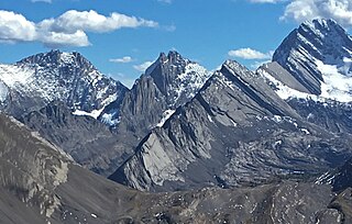
Mount Robertson is a mountain in the Canadian Rockies, standing astride the British Columbia-Alberta boundary between Palliser Pass and North Kananaskis Pass. The British Columbia side of the pass is in Mount Assiniboine Provincial Park. The mountain is named for Sir William Robertson (1860–1933), 1st Baronet, Chief of the Imperial General Staff from 1916 to 1918 during the First World War.
14. Mount Glasgow
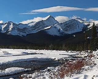
Mount Glasgow is a prominent 2,935-metre (9,629 ft) pyramid-shaped summit located between the Elbow River valley and Little Elbow River valley of Kananaskis Country in the Canadian Rockies of Alberta, Canada. The peak is visible from Calgary, weather permitting. Mount Glasgow's nearest higher peak is Mount Cornwall, 2.0 km (1.2 mi) to the southwest.
15. Mount Loomis
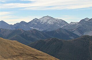
Mount Loomis is located on the border of Alberta and British Columbia on the Continental Divide. It was named in 1918 after Frederick Oscar Warren Loomis, a Canadian Army general who served in World War I.
16. Mount Engadine
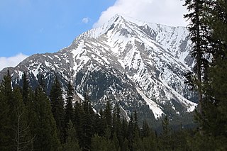
Mount Engadine is a 2,972-metre (9,751-foot) mountain summit located in the Spray River Valley of Kananaskis Country, in the Canadian Rockies of Alberta, Canada. It was named in 1917 after HMS Engadine, a seaplane tender of the Royal Navy present at the Battle of Jutland during World War I. The mountain is located in the Kananaskis Range in Alberta.
17. Mary Barclay's Mountain
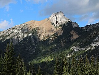
Mary Barclay's Mountain is a 2,260-metre (7,410-foot) summit located in the Kananaskis Range of the Canadian Rockies of Alberta, Canada. Mary Barclay's Mountain can be seen from Highway 40 in Kananaskis Country. The mountain's nearest higher neighbor is Skogan Peak, 3.0 km (1.9 mi) to the west, and Mount Lorette is to the immediate southwest.
18. Wasootch Peak
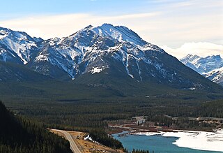
Wasootch Peak is a 2,352-metre (7,717-foot) mountain summit located in the Fisher Range of Kananaskis Country in the Canadian Rockies of Alberta, Canada. The peak is situated on the northern end of the ridge that separates Wasootch Creek from Porcupine creek. Wasootch Peak's nearest higher peak is Old Baldy, 1.54 km (0.96 mi) to the southeast. The peak may be seen from Highway 40, and is prominently featured from the ski slopes at Nakiska. Wasootch is from the Stoney language word wazi, which translated means unique.
19. Mount James Walker
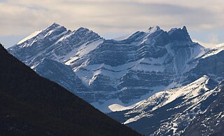
Mount James Walker is a 3,035-metre (9,957-foot) mountain summit located in Kananaskis Country in the Canadian Rockies of Alberta, Canada. Mount James Walker is situated within Spray Valley Provincial Park, and its nearest higher peak is Mount Galatea, 5.0 km (3.1 mi) to the northwest.
20. Ribbon Peak
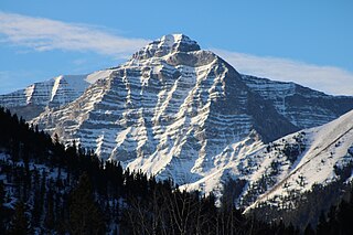
Ribbon Peak is a 2,880-metre (9,450-foot) summit located in Kananaskis Country in the Canadian Rockies of Alberta, Canada. Ribbon's nearest higher neighbor is Mount Bogart, 1.0 km (0.62 mi) to the southwest. Ribbon Peak is situated four kilometres northwest of Mount Kidd, and both can be seen from Highway 40 near the Kananaskis Village junction along Highway 40.
21. Gap Mountain
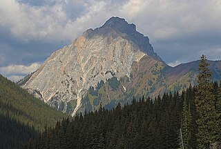
Gap Mountain is a 2,675-metre (8,776-foot) mountain summit located at the southern end of the Opal Range in the Canadian Rockies of Alberta, Canada. The nearest higher neighbor is Elpoca Mountain, 2 km (1.2 mi) to the east. Gap Mountain is situated 5 km (3.1 mi) south of Mount Wintour, within Peter Lougheed Provincial Park. Gap Mountain is a conspicuous peak seen from Alberta Highway 40 at Highwood Pass. It is a popular climbing destination because it offers exposed scrambling on its eastern flanks with excellent summit views of Kananaskis Country.
22. Wind Mountain
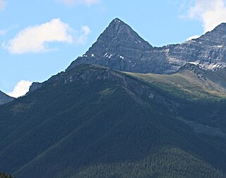
Wind Mountain is a 3,153-metre (10,344-foot) mountain summit located in Kananaskis Country in the Canadian Rockies of Alberta, Canada. Wind Mountain's nearest higher peak is Mount Galatea, 13.0 km (8.1 mi) to the south, and both are part of the Kananaskis Range. Wind Mountain can be seen from the Trans-Canada Highway in the Bow River valley, and from Highway 40.
23. Mount Cornwall
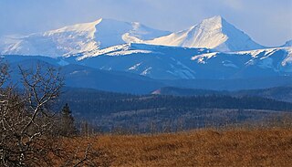
Mount Cornwall is a prominent 2,970-metre (9,740-foot) summit located between the Elbow River valley and Little Elbow River valley of Kananaskis Country in the Canadian Rockies of Alberta, Canada. The peak is visible from Highway 66, weather permitting. Mount Cornwall's nearest higher peak is Tombstone Mountain, 6.6 km (4.1 mi) to the southwest.
24. Storelk Mountain
Storelk Mountain is located on the border of Alberta and British Columbia on the Continental Divide. It was named in 1915. The toponym is a portmanteau that combines "stor" and "elk", as the mountain is positioned between Storm Creek and Elk River.
25. Threepoint Mountain
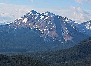
Threepoint Mountain is the descriptive name for a three-pointed 2,595-metre (8,514-foot) mountain summit located in the Elbow River valley of Kananaskis Country, in the Canadian Rockies of Alberta, Canada. it is situated southwest of Calgary and can be seen from Highway 66. Threepoint Mountain's nearest higher peak is Bluerock Mountain, 4.7 km (2.9 mi) to the south. The mountain's name was made official in 1951 by the Geographical Names Board of Canada.
26. Mount Jerram
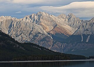
Mount Jerram is a 2,996-metre (9,829-foot) mountain summit located in the Opal Range of the Canadian Rockies of Alberta, Canada. Its nearest higher peak is Elpoca Mountain, 4.0 km (2.5 mi) to the south-southeast. Mount Jerram is situated east of Mount Wintour, within Peter Lougheed Provincial Park.
Share
How likely are you to recommend us?
Disclaimer Please be aware of your surroundings and do not enter private property. We are not liable for any damages that occur during the tours.
