14 Sights in Scharnitz, Austria (with Map and Images)
Legend
Welcome to your journey through the most beautiful sights in Scharnitz, Austria! Whether you want to discover the city's historical treasures or experience its modern highlights, you'll find everything your heart desires here. Be inspired by our selection and plan your unforgettable adventure in Scharnitz. Dive into the diversity of this fascinating city and discover everything it has to offer.
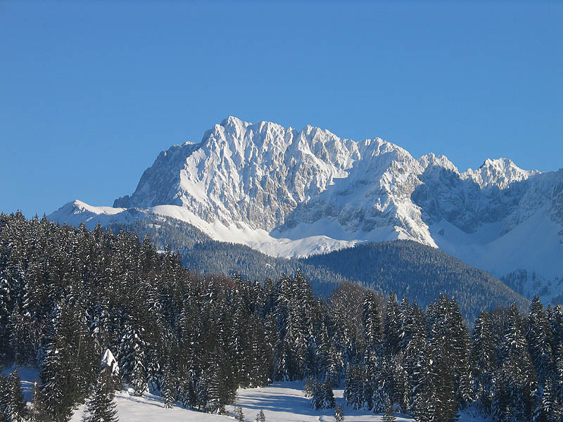
1. Grubenkarspitze

The Grubenkarspitze is located in the heart of the Karwendel in the Hinterautal-Vomper chain. The Rossloch, the most common starting point for the Grubenkarspitze, Dreizinkenspitze and Laliderer Spitze, is a cold pole and lies in the shade almost throughout the winter. It is often reached by mountain bike through the Hinterautal from Scharnitz. In spring, the Grubenkarspitze is quite popular as a ski tour. Although the Grubenkarspitze is located near the Laliderer Wände and its north face is about 1000 m high, it has never reached the popularity of the "Laliderer".
2. Große Seekarspitze

The Große Seekarspitze is a 2677 m high peak of the Hinterautal-Vomper chain in the Karwendel. The summit forms a pyramid with scree-covered steep flanks and is connected to the north by a ridge with the Kleine Seekarspitze. Towards the south-southwest runs the Spitzhüttengrat with the Lower and the Upper Spitzhüttenkopf. Near the Breitgrieskarscharte there is a bivouac box as emergency accommodation. The summit can be reached via one of the following four routes for the experienced and sure-footed mountaineer: the Neunerkar and the Breitgrieskarscharte, the Marxenkar, via the connecting path between Pleisenhütte and Karwendelhaus (Toni-Gaugg-Höhenweg) and from the south from the Hinterautal via the Breitgrieskar.
3. Larchetkarspitze

The Larchetkarspitze is a 2541 m high mountain between the Pleisenspitze in the west and the Große Riedlkarspitze in the east in the Hinterautal-Vomper chain. It is often done as a ski tour in winter and spring and serves as a worthwhile alternative destination to the Pleisenspitze. From the Pleisenhütte you cross along the summer path into the Mitterkar. The summit flank is about 40 degrees steep and leads to the right into a notch. From there, it goes to the highest point in difficulty level III− (UIAA).
4. Laliderer Wand

Die Laliderer Wände sind eine aufeinanderfolgende Reihe fast senkrechter Felswände in der Hinterautal-Vomper-Kette im Zentrum des Karwendels und eines der bekanntesten Klettergebiete der Nördlichen Kalkalpen. Die Wände sind etwa 900 Meter hoch und reichen bis knapp unter die Gipfelbereiche von Laliderer Spitze und Grubenkarspitze. Der höchste Punkt – als Laliderer Wand bezeichnet – liegt auf 2620 m ü. A., etwas östlich davon die Dreizinkenspitze.
5. Nördliche Jägerkarspitze

The Jägerkarspitzen are three closely neighbouring peaks in the Gleirsch-Halltal chain in the Karwendel. The Northern Jägerkarspitze is 2596 m above sea level, the Southern 2579 m above sea level and the Middle Jägerkarspitze is the highest of the peaks at 2608 m above sea level. To the west, east, southwest and southeast, the peaks emit pronounced ridges. The ridge running from the Mittlere Jägerkarspitze to the southwest to the Großer Katzenkopf is named after the German alpinist Hermann von Barth, the first climber of the Nördlicher Jägerkarspitze.
6. Porta Claudia

The Porta Claudia is a former fortification at the Scharnitz Pass, where the valley of the River Isar narrows near the village of Scharnitz, on the Bavarian border near Mittenwald. The Porta Claudia – or more precisely the Scharnitz Pass – is the start of the present federal highways, the B 2 (Germany) and the B 177 (Austria).
7. Wörner
The Wörner is a 2,476 m high mountain in the Karwendel on the border between Bavaria and Tyrol. It is part of the Northern Karwendel Chain that initially runs northwards to the Wörner and then swings east. The northwest ridge (Nordwestgrat) of the Wörner is very striking and easy to make out from many other peaks in the region.
8. Große Riedlkarspitze

The Große Riedlkarspitze is a 2585 m high mountain in the Karwendel in Tyrol in the Hinterautal-Vomper chain. Neighboring peaks are the Breitgrieskarspitze in the east and the Larchetkarspitze in the west.
9. Hochkarspitze

The Hochkarspitze is a 2,484 m high mountain in the Karwendel on the border between Bavaria and Tyrol. It is part of the Northern Karwendel Chain, which runs initially northwards before swinging east at the Wörner. The Hochkarspitze lies east of the Wörner summit and is the highest point of the massif that it forms jointly with the Wörner.
10. Rauhkarlspitze

The Rauhkarlspitze is a summit of the Hinterautal-Vomper chain. It lies between the Kaltwasserkarspitze in the west and the Moserkarspitze in the east. Its summit structure consists of the 2618 m above sea level high west summit and the 2619 m high east summit. To the north, the Rauhkarlspitze drops steeply to the Kleiner Ahornboden.
11. Östliche Ödkarspitze

The Ödkarspitzen are three peaks in the Karwendel mountains in the Austrian state of Tyrol in the Hinterautal-Vomper Chain between the ultra-prominent mountain of Birkkarspitze in the east and the Marxenkarspitze in the west. The highest of the summits is the Middle Ödkarspitze with a height of 2,745 m (AA). The Western Ödkarspitze is 2,712 m (AA) high and the Eastern Ödkarspitze is 2,738 m (AA) high.
12. Kaltwasserkarspitze

The Kaltwasserkarspitze is a mountain in the Hinterautal-Vomper Chain and, at 2,733 m (AA) m, is the fourth highest peak in the Karwendel mountains in Austria after the Birkkarspitze, Middle and Eastern Ödkarspitze. The Kaltwasserkarspitze is the eastern neighbour of the Birkkarspitze, its rugged summit dropping in a steep rock face to the valley of Kleiner Ahornboden. A long arête heads south from the mountain, on which are the Sägezähne and the Großer Heißenkopf and which separates the Östliche Birkkar from the Raukarl.
13. Kath. Pfarrkirche Mariahilf

The parish church of Scharnitz is located in the municipality of Scharnitz in the district of Innsbruck-Land in the state of Tyrol. The Roman Catholic Church, which is subordinate to the patronage of Mariahilf, belongs to the deanery of Telfs in the diocese of Innsbruck. The church and the former cemetery are listed as historical monuments (list entry).
14. Südliche Linderspitze

The Linderspitzen are three summits of the Karwendel range at the border between the Austrian state of Tyrol and the German state of Bavaria. Linderspitzen refers to three distinct peaks, the Northern Linderspitze, the Southern Linderspitze and the Middle Linderspitze.
Share
How likely are you to recommend us?
Disclaimer Please be aware of your surroundings and do not enter private property. We are not liable for any damages that occur during the tours.