12 Sights in Neustift im Stubaital, Austria (with Map and Images)
Legend
Welcome to your journey through the most beautiful sights in Neustift im Stubaital, Austria! Whether you want to discover the city's historical treasures or experience its modern highlights, you'll find everything your heart desires here. Be inspired by our selection and plan your unforgettable adventure in Neustift im Stubaital. Dive into the diversity of this fascinating city and discover everything it has to offer.
1. Habicht
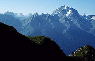
The Habicht is a mountain in the Stubai Alps of Austria. For a long time, the locals believed it to be the highest mountain in Tyrol, due to its prominence above the surrounding mountains. Despite what they thought, the highest peak in the Stubai Alps is Zuckerhütl which is 230 metres higher than Habicht. The name literally means "hawk" in German.
2. Elferspitze
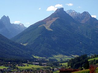
The Elferspitze is a mountain in the Stubai Alps in Austria and belongs to the Habichtkamm, which branches off from the main Alpine ridge near the Feuersteine and runs in a northeasterly direction to it.
3. Grawa Wasserfall
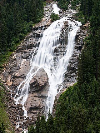
The Grawa Waterfall is a waterfall of the Sulzaubach in the upper Stubai Valley (Tyrol/Austria) on the orographic right side of the valley opposite the Grawa-Alm. It is very well visible from the Stubai State Road, which ends 2.7 km further into the valley at the valley station of the Stubai Glacier Cable Car, and can be reached via a short footpath. At about 85 m, the Grawa waterfall is the widest in the entire Eastern Alps and has a drop height of about 180 m. The not quite vertical, banded rock subsoil allows its cascades to atomize many times over and thus contributes to the scenic charm.
4. Schrandele
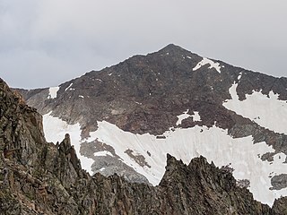
The Schrandele is a 3392 m high mountain in the Alpein Mountains, a subgroup of the Stubai Alps in the Austrian state of Tyrol. The mountain has the shape of a steep pyramid, which clearly stands out from the surroundings. The Schrandele emits right-angled ridges in all four directions, which result in a cross shape from a bird's eye view. Since the mountain places high demands on the ascent, it is one of the less visited peaks, in contrast to the more easily accessible but higher Schrankogel with 3496 meters altitude. The question of the first ascent of the Schrandele has not been clearly clarified. According to literature, Alois Tanzer is said to have been on the summit as early as the end of the 1860s as part of the national survey, but the first tourist ascent on 24 August 1886 by Ludwig Purtscheller and Josef Reichl from Steyr is certain.
5. Roter Grat - Cresta Rossa
The Red Ridge is a 3099 meter high mountain on the border of Tyrol (Austria) and South Tyrol (Italy). The normal route leads from the Nürnberger Hütte as a glacier tour over Freigerscharte, or Rotgratscharte, whereby the summit ridge requires easy climbing in both variants. The path is marked up to the lake above the hut, then only cairns to the glacier, walking time 3 or 21/2 hours.
6. Hoher Burgstall
The Hoher Burgstall is a mountain, 2,611 m, in the Kalkkögel mountain chain in the Stubai Alps, southeast of the Schlicker Seespitze (2,804 m) mountain, the tallest in the Kalkkögel. Its summit offers a good view into the Oberbergtal, the upper Stubaital, the Serles ridge and the majority of the Kalkkögel.
7. Östliche Seespitze
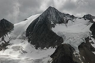
The Östliche Seespitze is a mountain, 3,416 m (AA), in the Stubai Alps in Austria. It belongs to the Alpeiner Mountains and is their second highest peak after the Ruderhofspitze. In addition, it is the highest point in the chain that runs northeast from the Westliche Seespitze, which separates the Falbesontal valley in the southeast from the Alpeiner Valley to the northwest.
8. Westliche Seespitze
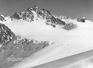
At 3355 m above sea level, the Western Seespitze in the Stubai Alps is 61 m lower than the neighbouring Eastern Seespitze and 119 m lower than the Ruderhofspitze towering south of it. It belongs to the group of Alpeiner Mountains and is located in the Austrian state of Tyrol.
9. Kalkwand
The Kalkwand is a 2564 m high mountain in the Stubai Alps in Tyrol. The multi-pronged ridge structure of the limestone wall lies northeast of the Pinnisjoch, a transition between the Pinnis and Gschnitz valleys. The summit is the first elevation in the Serleskamm ridge, which runs northeast from the Pinnisjoch. The Kalkwand is considered the hut summit of the Innsbrucker Hütte. Therefore, the landlord of this hut erected the cross on the top of the limestone wall, which still exists today.
10. Ruderhofspitze
At 3,474 m (AA) the Ruderhofspitze is the fourth highest mountain in the Stubai Alps in Austria. It is part of the Alpein Mountains and lies in the Austrian state of Tyrol. As a result of its topographic isolation and good all-round views it is one of the most visited mountains in the Stubai. An almost two-kilometre-long arête, the Grawawand, runs away from the summit to the east. Less prominent ridges run south and northwestwards from the Ruderhofspitze. The peak was first ascended on 30 August 1864 by Karl Baedeker, Anton von Ruthner and mountain guides Pankraz Gleinser and Alois Tanzer.
11. Östliche Knotenspitze
The Östliche Knotenspitze is a 3101 m high mountain in the Stubai Alps in the Austrian state of Tyrol. More important for tourism than the main summit is the Kreuzspitze, a secondary summit about 100 metres to the southwest, which also carries the summit cross.
12. Georgskirche
The Ranalt Chapel is located in the mountaineering village of Ranalt at the foot of the Stubai Glacier in the municipality of Neustift im Stubaital in the district of Innsbruck-Land in the state of Tyrol. The Roman Catholic chapel, which is subordinate to the patronage of St. George, belongs to the deanery of Matrei am Brenner in the diocese of Innsbruck. The chapel has been a listed building since 2012 (list entry).
Share
How likely are you to recommend us?
Disclaimer Please be aware of your surroundings and do not enter private property. We are not liable for any damages that occur during the tours.
